Digital Transformation
Identifying, Mitigating UXO
Hidden Hazard Below: Turning Subsea UXO From “Red Dots” Into Real Decisions
Offshore work is hard enough when the only variables are weather, water depth and equipment availability. But in many parts of the world — particularly in European waters—there’s another hazard that doesn’t show up on the surface: unexploded ordnance (UXO) and other explosive remnants of war (ERW) sitting on, or buried just beneath, the seabed. Matt Grove – EMEA Regional Segment Manager – Offshore and Becky Bodger – EMEA Customer Solutions Team Lead & Geophysicist, Seequent, discussed the UXO problem and solution recently with Maritime Matters: The MarineLink Podcast.
By Greg Trauthwein
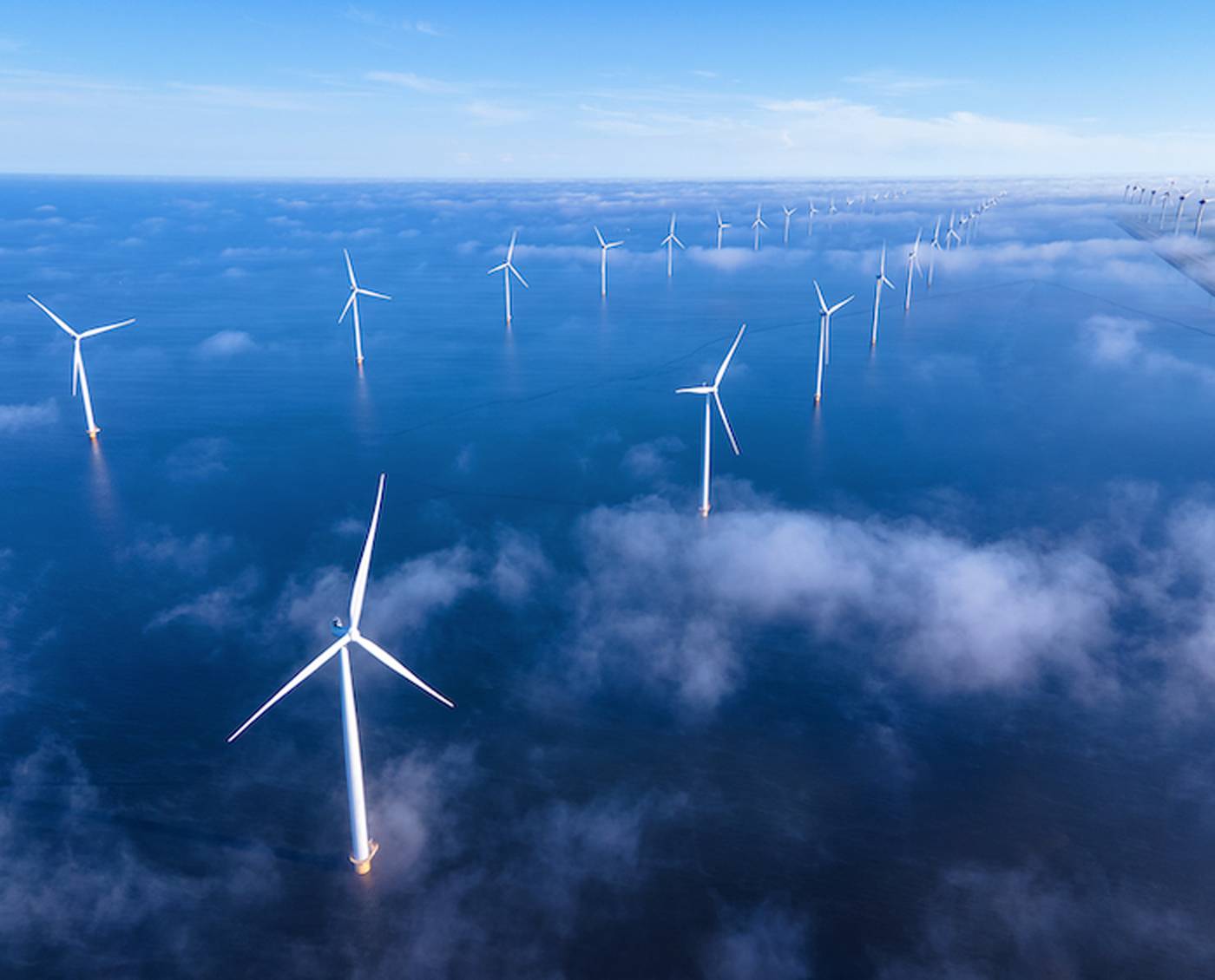
UXO is a legacy problem from conflicts past, but it’s a very current problem for developers and contractors trying to build the infrastructure the modern economy demands — offshore wind farms, export cables, interconnectors, port deepening projects, dredging campaigns, pipelines, nearshore utilities and more. Nobody wants to find a bomb on the seabed. Even more, nobody can afford to miss one.
That “needle in a haystack” reality — combined with the operational complexity and cost of working underwater — is exactly where Seequent positions itself. “Think of Seequent being the subsurface specialist,” said Matt Grove, EMEA Regional Segment Manager – Offshore at Seequent. “We’re looking underneath the seabed to try and find what’s there… ultimately trying to de-risk that subsurface, whether that’s geophysics or geotechnical data… specifically UXO.”
Grove and Becky Bodger, EMEA Customer Solutions Team Lead & Geophysicist, joined Maritime Matters to put shape around the size of the threat — and the practical workflows that help teams find, identify and mitigate subsea UXO without turning offshore projects into open-ended investigations.
What is UXO?
“UXO” is widely used in the industry, but it’s worth being explicit, Bodger said. UXO is unexploded ordnance: munitions, bombs or other explosive items that were deployed during conflict and did not detonate. Closely related terms include ERW (explosive remnants of war). In practice, she noted, the scope can also include fragments and other left-behind items. The highest-risk class is the one nobody wants to discover the hard way: munitions that remain intact enough to detonate.
The ocean adds its own twist. In addition to “active combat” items that ended up offshore, there are also deliberate dump sites created after wars — munitions pushed into the sea to get them out of circulation. Add decades of fishing activity, and the picture gets more complicated: fishermen historically were paid to take munitions offshore; others pulled up dangerous items unintentionally while trawling.
The result is a problem that isn’t going away — and one that, in many areas, collides directly with new build activity. “We’re building into places offshore where they dumped all these munitions after the wars,” Grove said. “It’s a challenge that keeps presenting itself.”
“Millions of Targets”
While offshore UXO is often discussed through a European lens — Baltic Sea and North Sea wind farm activity, dense marine construction corridors, decades of legacy conflict — Bodger stressed the global scale.
“There’s millions of items… across the globe,” she said, pointing to heavily affected regions where conflict left persistent contamination. She cited Laos as a top-impacted country, and also referenced emerging unknowns in Ukraine. She added that the marine environment is heavily affected in World War-era waters, noting estimates that the Baltic and North Sea alone hold roughly 1.9 million tons of unexploded ordnance.
Beyond detonation risk, Grove emphasized another long-term hazard: degradation. “These things are 80, 90 years old, they degrade. We don’t really know what’s inside them.”
In other words: the risk profile isn’t only operational safety; it’s also environmental and reputational risk, and potentially long-tail consequences that are far harder to remediate later.

The Offshore Problem: Too Many “Red Dots”
On land, UXO workflows benefit from relatively straightforward positioning and access. Underwater, those assumptions break down quickly.
“For me, the biggest challenge is… lack of GPS,” Bodger said. “You can’t connect to satellites underwater. We need to know where your sensors are … and that doesn’t exist in the marine world comparing to what we do on land.”
And then there’s the economics.
Offshore investigations are expensive, and the cost curves can be brutal: survey, process, interpret … then send down EOD experts and divers to investigate target lists. “The cost is not comparable to the investigation step offshore,” Bodger said. “With our software and our solutions, we’re reducing that final list … less investigation, more surveying… means they spend less money later.”
Grove described the practical reality that survey teams and project owners face after a magnetometer campaign: target maps filled with anomalies — thousands of “red dots.” Magnetometry detects changes in Earth’s magnetic field caused by ferrous content in the subsurface. That means the system can light up for UXO — but also for plenty of harmless debris. “It could be a shopping trolley, it could be a reel of cable… you get a lot of data coming through,” Grove said.
The downstream problem is decision-making. If a project owner receives a deliverable with a target list of thousands of anomalies, every anomaly becomes a potential UXO, and therefore a potential schedule and cost hit. “They have to make a decision based on what they’re being delivered,” Grove said. “If there’s thousands… that’s potentially thousands of potential UXOs, which have to be whittled down.”
Reduce Uncertainty
The trick isn’t just “more data,” rather it’s data that is fit for purpose, processed reliably, integrated with other sources, and used to reduce uncertainty — especially uncertainty caused by false positives and false negatives.
“One of the biggest challenges for our customers is the false positives, false negatives,” Grove said, describing the uncertainty created by clutter on the seabed. In magnetometry, the physics can be non-unique: small and shallow can resemble big and deep, and vice versa. That’s why integration matters.
Seequent’s answer in the marine UXO space is its UXO Marine module within Oasis montaj—built as part of a modular, end-to-end geophysics workflow. Bodger described it as covering planning through QA/QC, map/report generation, and target list creation from processed magnetic data.
Key capabilities in that workflow include automated target picking: users can set parameters based on what the “smallest detectable object” is for a given survey design and mission requirement, and pick everything above a minimum threshold. The module also offers modeling tools that can provide depth estimates — critical information when you’re trying to decide what requires investigation, what can be discounted, and where to shift infrastructure if needed.
But Bodger was clear: in marine UXO, magnetometry is necessary but often not sufficient. That’s why Seequent focuses heavily on integrating and visualizing multiple data types in one place. “You need side scan sonar, multi-beam, sub bottom profile,” she said. While Oasis montaj may not process every format, the ability to bring in and visualize supporting datasets — and view seismic SEG-Y, for example — helps teams build a clearer picture of what’s on the surface versus what’s buried.
Grove put it plainly: if magnetometry shows an anomaly, but multibeam or side scan provides context, you can start to answer the first-order question: is it on top of the seabed, or under it? The outcome isn’t academic — those determinations can change where a turbine foundation sits, how a cable route is adjusted, or where risk mitigation is prioritized.
Beyond UXO
One of the more pragmatic points in the discussion: UXO isn’t a standalone “checkbox.” It’s often the first hard gate in a sequence of subsea decisions.
Bodger noted that Seequent’s portfolio extends beyond UXO Marine into products like Leapfrog for geological modeling, where targets and hazards can be integrated into a broader ground model — including clays, silts and interpreted seabed structures. Grove referenced recent work around cable routing and thermal response, where understanding sediments and their behavior directly influences design and operational performance.
In short, UXO findings don’t live in a vacuum. They inform the geotechnical interpretation, and they ultimately influence engineering decisions — foundation placement, cable burial strategy, route selection, and other infrastructure choices.
Eliminating Silos
Offshore projects are multi-year, multi-party undertakings. Owners, contractors, regulators, and a wide range of specialist teams touch the data. Bodger argued that one of the industry’s biggest challenges is still organizational: silos between teams, disciplines and deliverables.
Seequent’s push here is connected workflows — particularly with cloud-based project management via its platform, Central. The proposition is straightforward: upload Oasis montaj projects from the vessel, allow shore-based stakeholders to view results, reduce the number of people who need to be offshore, and accelerate sign-off and demobilization decisions.
“The quicker we can make that available, the quicker we can get sign-off,” Bodger said, emphasizing the real costs of waiting until the end of a campaign for final deliverables.
Within the UXO workflow itself, Grove described how different layers of the project chain — from data acquisition teams to consultants to client representatives — can interact with the same datasets and tools, using standardized imports/exports or shared access through Central.
And in a very practical bonus for owners: the same geophysical datasets can be reused across compliance and planning requirements. Bodger noted that archaeology surveys are often required to confirm there are no shipwrecks or seabed items of cultural importance. Rather than running redundant surveys, teams can reprocess existing datasets with different objectives and signatures in mind — geological features, paleo-channels, archaeology targets — using the same software environment.
Taking the First Step
When asked what a developer should do first if they’re starting a project in UXO-prone waters, both Grove and Bodger converged on planning discipline.
Start with documentation and repositories. Do a desktop study to understand what types of munitions are likely present. Then design the survey around the smallest target you must detect — because that decision drives everything else: line spacing, sensor height, number of magnetometers, and whether the campaign should focus on total field, gradients, or other collection approaches.
“The lowest detectable item… is really important,” Bodger said. “Your very first step in designing the survey is so important.”
Grove added a reality check that every software company eventually has to state out loud: even the best processing and modeling can be undermined by poor data coverage. Dense, high-quality datasets don’t just improve results — they can be the difference between confident decisions and expensive uncertainty.
The Bottom Line
Subsea UXO is not a theoretical hazard, and it’s not limited to one region or one industry segment. It’s a global legacy problem showing up in the busiest corridors of offshore development — often in the exact places where projects can least afford delays.
The good news is that the industry is steadily moving from “spot it and react” to “characterize it and decide” — using better workflows, better data integration, and tools that shrink target lists and reduce the need for costly investigations.
Or as the conversation kept returning to, again and again: it’s all about the data — good data, integrated data, and the ability to turn “red dots” into real decisions.