Region Report
Pacific Northwest
“Big River” Means Big Commerce
By Capt. Marc Deglinnocenti
The “Big River” is what several Native-American tribes call the Columbia River. That big river just happens to be the largest river system in the Pacific Northwest of the United States. It is some 1,200 miles in length stretching from British Columbia, Canada, through Oregon and Washington, and all the way to the Pacific Ocean. It has earned its nickname well, but it’s much more than just being big. It’s a lifeline of commerce for much of the USA, and that means all sorts of commerce too. The most obvious one is the commercial shipping running up and down its length.
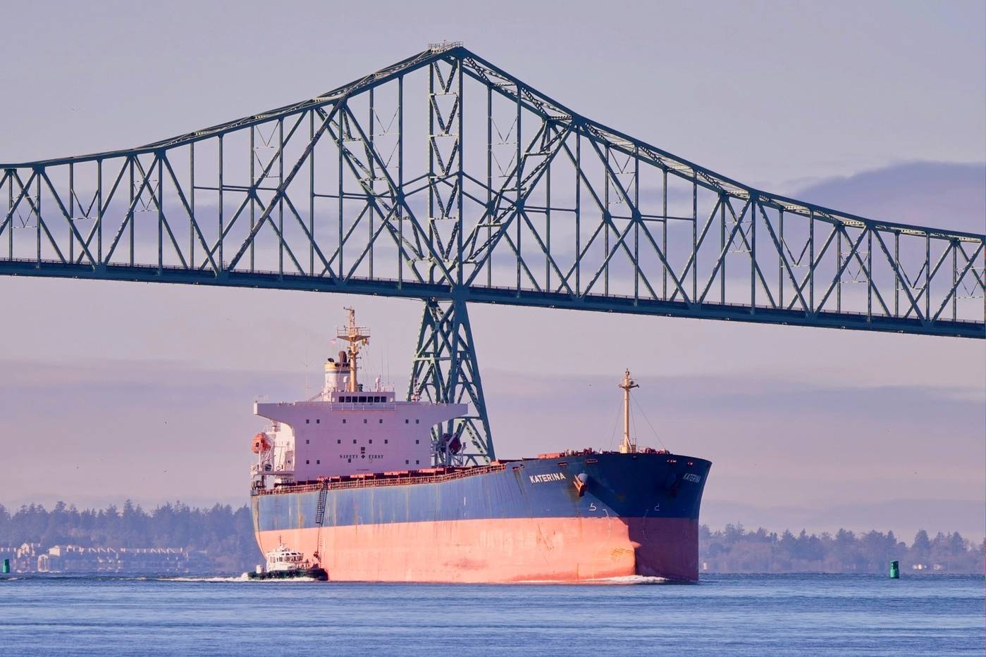
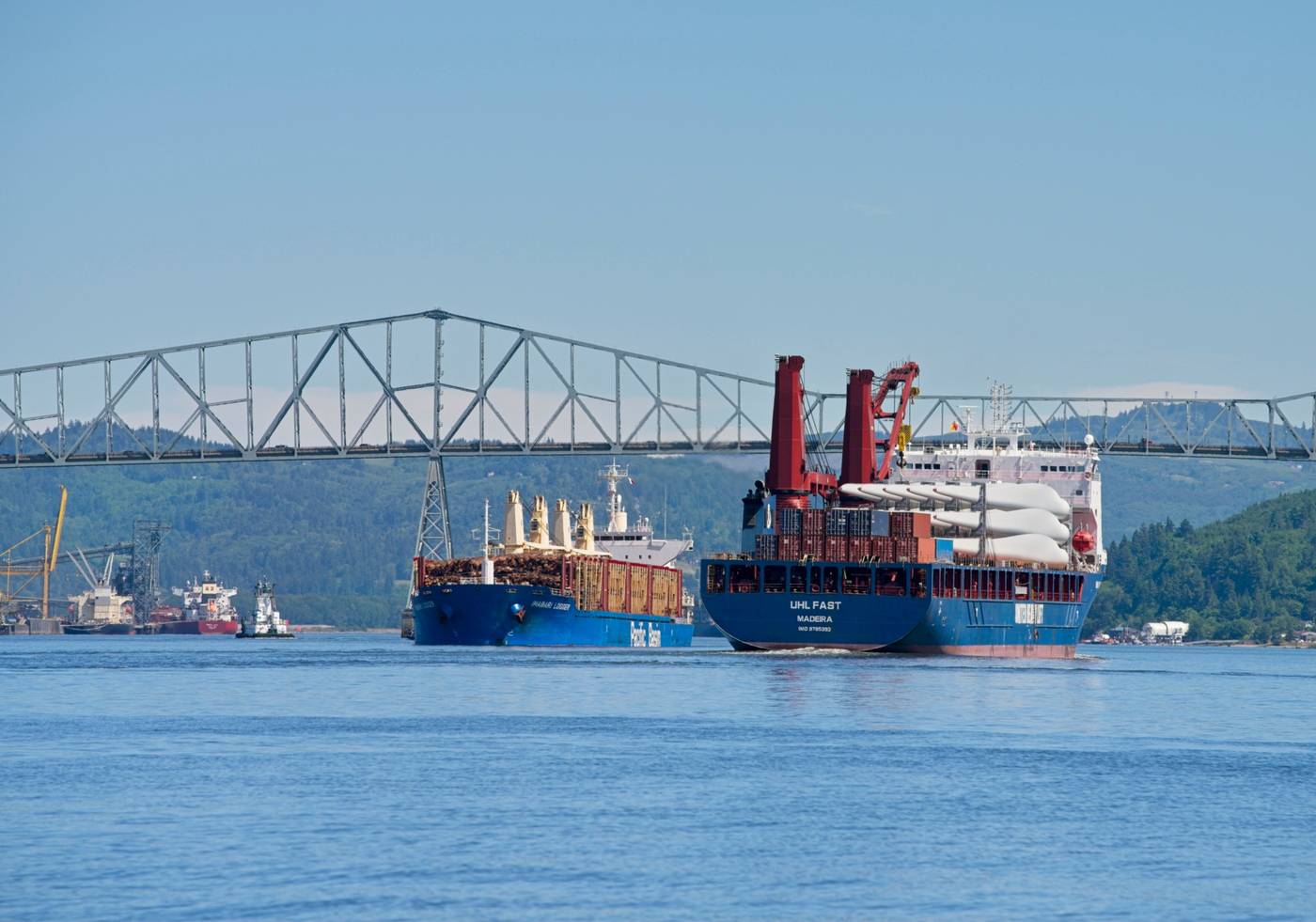
If you sit by the banks of the Columbia River, it won’t take long before you see large ocean-going ships of every description plying its waters. Many jaws drop when they see huge containerized cargo ships moving between its banks. Large bulk carriers, oil tankers, tugboats pushing and pull barges, and even cruise ships are some more types of vessels to be seen there. The list goes on and on, but they all had to cross an extremely treacherous entrance from the Pacific Ocean or bar to get there.

Ask any Columbia River bar pilot about the entrance to the river from the Pacific Ocean, and they will tell you that the bar is not to be underestimated. The mouth of the river is littered with shipwrecks, thus earning the name, “The Graveyard of the Pacific”. Over 2,000 vessels have sunk there with over 200 of them being large ships. Just because you might be on a large ship doesn’t mean that you can safely cross the bar at any time. This holds true especially during storms and at the wrong tide. This is due to the simple fact the river water is constantly flowing out to the ocean. When the tide rises the tidal currents try to enter the river. These flooding tidal currents clashes somewhat violently with the natural flow of the river. The minimum result is always a rough ride. The maximum result is the floundering of numerous vessels throughout the years. Those sinkings have cost over 700 lives. I have crossed that bar several times during my career as a master mariner. I always made sure that the tidal currents were ebbing and therefore running in the same direction as the river’s currents. Sure, it was slower going and cost more in fuel, but it was better to be safe than sorry. After all, that’s where the U.S. Coast Guard trains their small boat rescue personnel at the National Motor Lifeboat School. That should tell you something about the Columbia River bar right there! The river itself has its own safety issues too.
The good thing about the Columbia River is that it’s well marked. There are numerous range markers up and down the river along with many other types of markings. The bad news is that some of the river’s hazards include wing dams that are used to control water flow to help prevent premature bank erosion. Wing dams are commonly made of short wooden pilings stretching out partially into the river from the bank. They are not usually marked during the day nor lighted at night. They are mostly a hazard to small recreational vessels and small fishing vessels. As long as the larger ships stay in the main channel, they are not of much of a concern outright. They can become a concern to larger shipping though, because they are not maintained very well. It’s not uncommon for pieces of them to break off and find their way into your propellers and steering rudders. Those along with floating trees and partially sunken roaming pier and wharf pilings know as deadheads also play a part in troubling mariners. Yes, the river is occasionally subject to fog too. Despite these hazards much commerce continues transit on the river.
According to a United States Department of Agriculture study, barges alone carry 3,933,470 tons of cargo each year on the river. Most of that cargo consists of agricultural products such as wheat. The study goes on to claim that nearly 2,000 jobs are created for those barges that move $345,568,196 worth of cargo each year on the Columbia and Snake Rivers. That’s just the tug and barge traffic! Those tugs and barges often reach as far as Lewiston, Idaho. That’s 465 miles up the Columbia River from the Pacific Ocean and through eight different locks. The Port of Lewiston lies almost in a perfect Easterly direction from the mouth of the Columbia River. It’s the most inland port on America’s West Coast. From there the trucks and the trains take over moving the cargo. The grain is loaded into silos and then poured into truck and train bulk carriers. The cargo containers are much easier to manage though.
The beauty of cargo containers is that they are part of what’s called the Intermodal Transportation System. A container is loaded by hand or by forklift only once. Then it is placed on a ship, then a train, and then a truck. The truck delivers it to a store or warehouse where the container is unloaded by hand or a forklift, once again, only once. That transportation system saves a tremendous amount of time and labor. Labor and work aren’t the only activities of the Columbia River though.
Recreational boating flourishes on the Columbia River. Sport fishing along the river and boating of every type can be seen up and down the river. The fishing would be better if it wasn’t for the hydroelectric dams blocking the river. Each dam is equipped with fish ladders to help the salmon and Steelhead trout migrate up the river. That’s true except for the Columbia River’s Grand Coulee Dam. It’s the largest dam in North America, and it has no fish ladders. Fishing seems to have taken a back seat to wind surfing or windsailing though. Windsurfing is very popular through the windy Columbia River Gorge. I know, because I had to dodge quite a few of them while steaming through there. It’s still a beautiful sight to see the many different colored sails crisscrossing the blue river banked by tall green mountains. You can never really get tired of the river’s beauty despite the heavy wind surfer traffic through the Gorge. There’s also a highway and a railroad along the river that helps move that commerce, but the large ships still carry the lion’s share of the load.

The Port of Portland, Oregon reports that by the year 2040 grain exports might reach 11.1 million metric tons per year. Other dry bulk goods were recorded as 1.7 million metric tons in 2018, and those are expected to rise to 2.1 million metric tons in 2040. The port saw 260,000 automobiles pass through it in 2018, and that’s on the rise too. By 2040 the port predicts that 67,000 Twenty Foot Equivalent Units (TEUs) containers will pass through. Rail service is expected to carry 107,000 TEUs by then as well. So, it’s bustling commerce both in the river and around it, and that’s just for Portland. The interconnecting waterways of the Maritime Highway System also add to transportation logistics. There’s the connecting Snake and Willamette Rivers commerce to consider as well. All of that Columbia River commerce totals 56 million tons of moving cargo per year. That’s a total of $21 billion per year in cargo value alone. That doesn’t include all of the jobs and supporting businesses that supports all of that moving cargo. Don’t forget all of the work that the Coast Guard and the Army Corp of Engineers perform on the river each year too. The mouth of the Columbia River needs to be dredged often. That’s where most of the river silt is naturally deposited. Seeing a dredge working the lower portion of the Columbia River is a common sight. One thing is for sure, the Columbia River certainly is a Big River with big jobs and big commerce seen there every day.
About the Author
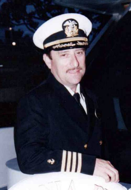
Capt. Marc Deglinnocenti
Capt. Marc Deglinnocenti has sea time on various types of vessels dating back to 1974. Those vessels included conventional and tractor tugs, sailboats, ferryboats, water taxis, training ships, warships, cargo barges, containerships, near coastal passenger vessels, paddlewheels, and research vessels to name a few. He was in the U.S. Merchant Marine for 33 years, 25 of which as a master mariner. He was also a designated qualified engineer and held many individual certifications and positions on ships such as QMED, able bodied seaman (lifeboatman along with the AB), unlimited radar observer, shipboard firefighting, and assistance towing endorsement. He served as an engineering officer, deck officer, commissary officer, and he even was a California State credentialed maritime teacher.